Image
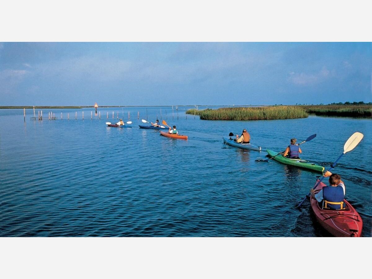
TOP PADDLING TRIPS ON THE LOWER SHORE
It’s no secret that the Eastern Shore of Maryland is an outdoorsman's paradise and a place of exceptional beauty and powerful history lessons. In particular, Dorchester County on the mid-shore, is garnering quite a bit of attention lately, as it has been listed in the top 25 Amazing Journeys for 2022 by National Geographic. With the Harriet Tubman Underground Railroad Visitor Center and Blackwater National Wildlife Refuge, Dorchester County certainly deserves the attention! A walk through the visitor center is a truly moving experience, and then heading out to explore the waters of the refuge is a real treat, whether you’re birding, paddling, hiking, or fishing.
While Dorchester is in the spotlight (and rightfully so!), there are miles upon miles of lesser-known creeks and coastlines to explore just a short drive down the shore on Route 13. The Lower Shore of Maryland and the Eastern Shore of Virginia should be on every paddler’s bucket list. Bald cypress swamps, endless marsh creeks, world-class birding opportunities, and white, sandy beaches provide a paddling paradise on the Chesapeake like none other.
I’ve been kayaking the Eastern Shore of Maryland and the Eastern Shore of Virginia for well over a decade. From Kent Island and Tuckahoe Creek to Cape Charles and Fisherman Island, the Chesapeake and its tributaries just speak to my soul. Sometimes I paddle for exercise. Sometimes I paddle with my family. Sometimes I paddle to escape the stresses of everyday life for a few hours. And sometimes I paddle just to experience silence. The lower shore has this silence – a silence that is strong enough to bring peace to just about anyone that ventures out to hear it.
So where are these places and how do you get to them?
While Worcester County is most known for the resort town of Ocean City, most of Worcester is actually pretty rural. Right smack in the middle of the county is a property managed by The Nature Conservancy, Nassawango Creek Preserve. Feeding into the Pocomoke River just west of Snow Hill, Nassawango Creek is a delightful, off-the-beaten-path paddling trip. The launch is located on Red House Road, right at the bridge going over the creek. Parking is no more than a few spots marked on the side of the road, pretty much in the grass. When I launch here, I feel instantly immersed in nature. The creek banks are lined with towering bald cypress trees, and if you time it right (late spring), you won’t hear much except the call of the prothonotary warbler, a species that funnels through this wildlife corridor during migration. Of the handful of times I’ve paddled this creek, I’ve seen beavers, warblers, painted turtles, bald eagles, river otters, and white-tailed deer. And while I haven’t spotted them, I’ve definitely heard both barred owls and great horned owls somewhere off in the woods.

Deal island, Will Parson photo courtesy the Chesapeake Bay Program
Just 15 miles west of Princess Anne, Maryland is the quaint town of Deal Island. Known for its oystering heritage and skipjack races, the island is a Somerset County gem. Before you even reach town, there are two spots to launch a kayak or paddleboard to explore the Deal Island Wildlife Management Area. First, I recommend exploring the water trails of Monie Bay by launching at the Dames Quarter boat ramp. There are marked trails of varying levels of difficulty so it’s an excellent choice for someone that is new to paddling or navigating marsh creeks. On one of the advanced trails, there’s even a small beach to get out and stretch.
On the other side of Route 363 is a launch within the Wildlife Management Area. From this launch, start by heading south. If you turn to the west, you’ll reach the towns of Deal Island and Wenona where you might be able to grab a bite to eat. If you want to experience some solitude, head to the east and the only sounds you’ll likely hear are clapper rails hidden in the marsh.

Although Corker’s Creek is probably one of the more well-known paddling locations on the lower shore, it’s still a lovely, shaded escape from the tourist towns of Worcester County. Your best bet is to launch from the boat ramp at Pocomoke River State Park’s Shad Landing. There is a two-mile loop that connects with the river, but I personally like to head further up the creek and under Route 113! I’ve paddled this creek several times, and each time I am amazed at how much beauty there is to discover, so close to the highway.

Janes Island is also a pretty popular spot to paddle, and in the summer the main Daugherty Creek Canal can be somewhat congested with boat traffic. But once you cross the canal and enter the labyrinth of salt marsh creeks, the noise of the power vessels will just be a quiet buzz off in the distance. The park has marked several water trails throughout the marsh and there is an accompanying map on the DNR website. While I could paddle marsh creeks all day to count diamondback terrapins and listen to osprey, the highlight of Jane’s Island, for me, are the beaches. Some of the beaches are less than two miles from the park’s boat ramp, which is super convenient if you’re bringing little ones along for the adventure! And if you’re up for a longer paddle, you can reach parts of the beach that are miles from the park and other people! If a day trip doesn’t fulfill your adventure needs, they also have three primitive, paddle-in campsites – just make sure you reserve in advance!
Pitts Creek is yet another creek off the Pocomoke River, but the launching point, Pitts Landing, and most of the creek itself, is in Virginia. To be perfectly honest, I haven’t paddled Pitts Creek in over a decade, but when my husband and I were exploring its twists and turns one day back in 2011, something about it spoke to my soul. I just remember stopping occasionally to pull my paddle out of the water and just listen. The fact that the only thing I could hear was the breeze rushing through the marsh grasses was captivating. I could not hear a car, a boat, or an airplane passing over. I couldn’t see a house, a power line, or any sign of human life. From that moment going forward, I knew kayaking was going to be a big part of my life.

If your main goal is to get far, far away from others, and experience that authentic lower shore silence, put the Saxis Wildlife Management Area at the top of your list. There are two soft launches, Marsh Market and Cattail Creek, that will give you access to paddling this area. Marsh Market will put you at the mouth of Messongo Creek, a meandering marsh creek that extends several miles up from the launch. The Cattail Creek launch will put you into the creek at first, and then if you head west, you’ll reach the Bay in a little over a mile. The Saxis Wildlife Management Area allows primitive camping, and there are a few small beaches within three miles of the launch that could be the perfect spot to pitch a tent! For information on camping, visit the Virginia DWR website.

If an out-and-back paddle isn’t your style and you’d prefer to paddle a loop, I highly recommend Parkers Marsh Natural Area Preserve. Located just south of Onancock, the preserve is best accessed from Broadway Landing. The loop is about 7.5 miles, and is best explored by experienced paddlers only, as wind and waves can be a factor when paddling the open Bay, however the northeast portion of the preserve can be accessed from Schooner Bay Landing, making for a more intermediate level, 5-mile round trip. I brought my sister out to Parkers Marsh last year. She is from the mountains of Colorado and sometimes it’s hard to impress her with scenic vistas and outdoor adventures when she comes to visit, but she was blown away by the scenery! The preserve has gorgeous sandy beaches on the west side, and peaceful, meandering marsh creeks on the east side. One very important thing to note is that Parkers Marsh is home to the federally-endangered tiger beetle. It is also listed as an Audubon Important Bird Area. Leave your dog at home on this trip, tread lightly, and practice Leave No Trace ethics.


This past summer I had the incredible opportunity to join forces with VirginiaWaterTrails.org to help them leverage their new paddling resources. I wanted to gather content from a lesser-known paddling spot so I chose Hacks Neck, a place I had never heard of prior. Wow, did it blow me away! From exploring expansive sand bars exposed at low tide, to paddling through a small pod of dolphins outside Harborton, I still get giddy thinking about that trip!
If you choose to launch at Hacks Neck, the road leading to the launch feels like you’re entering someone’s private property, but you’re not! There is a working waterfront with piles of crab pots right up next to the roadway, but I promise there is a public soft launch at the end of the road. When I launched here I headed into the Bay and to the north. I have not yet explored to the south.

While I have not paddled to Savage Neck Dunes Natural Area Preserve, I have explored it on foot, and I’m sure I’d be hard-pressed to find anyone that wouldn’t be in awe of its towering dunes. The elevation of some of the dunes reaches over 50 feet and they are among the highest points along the Lower Shore.
Arriving by kayak or paddleboard is a pretty straight shot from the public beach in downtown Cape Charles, but I would only recommend this trip for experienced paddlers. Four miles one-way, across open water, could be a challenge if the Bay has any chop to it. In addition, like Parkers Marsh, Savage Neck Dunes also has some fragile natural resources, so be sure to practice Leave No Trace principles, whether you visit by land or by sea.
When you talk to my friends, family, coworkers, and mere acquaintances, it’s no secret that kayaking is my thing. Discovering off-the-beaten path places to paddle on Delmarva sparks so much joy in me, that I can’t contain it; I have to share it with others. So next time you are out exploring the lower shore, even if you’re not there to paddle, hop off Route 13, turn down that random dirt road, and experience the silence of the Lower Shore.

Canoe Nassawango Creek, one of Maryland's most pristine waterways, and visit Furnace Town, the 19th century village and iron furnace.

Located within the 15,000 wooded acres of Pocomoke State Forest in the Southwestern section of Worcester County, Pocomoke River State Park provides a base for a vast array of outdoor and tourist activities.

Janes Island State Park encompasses 2,900 acres of Chesapeake Bay marsh, beach, and highland. The park is dissected by many small waterways, with 30 miles of trails marked for canoes and kayaks.

Savage Neck Dunes Natural Area Preserve with its mile of Chesapeake Bay shoreline is special for its large bay-side dunes and associated plant communities.


Patchy rain nearby, with a high of 66 and low of 47 degrees. Don't forget your umbrella! Cloudy in the morning, patchy rain nearby in the afternoon, clear during the evening, overcast overnight.